A block over Europe: what the models say, and where Skåne sits
2026-10-30
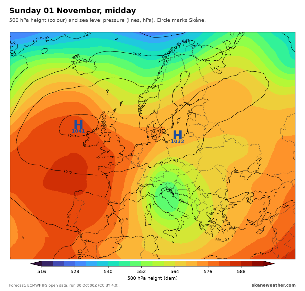
The current expectation from the global models is a strong high parking over Britain and western Europe, an omega block, and holding through the first week of November: fog in the west, cold and storms in the east and south, and a warming high in the stratosphere that could bring Arctic cold later in the month. We checked each part against this morning's ECMWF run (30 Oct 00Z), then zoomed in on Skåne with the two 2.5 km models that cover us, MEPS from MET Norway and HARMONIE from DMI.
Europe, part by part
| The expectation | Today's runs in detail | Verdict |
|---|---|---|
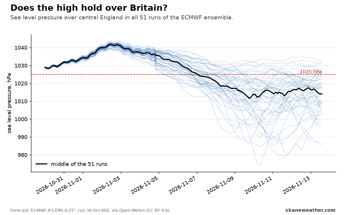
| A blocking high over the UK, through the first week of November and possibly longer | A 1040 hPa high over Scotland from Monday to Wednesday. All 51 ensemble runs keep it until Wednesday 4 Nov, 3 in 4 still on Friday 6 Nov, fewer than half on Saturday 7 Nov | Right for the first days; "longer" is not in the ensemble |
| Dry and quiet in the west, fog and low cloud in the Benelux countries, northern France and valleys; UK days of 10 to 12°C | London 10 to 14°C and dry all week. Paris and Brussels warmer at 1.5 km than at the ground for 30 to 40 hours of the week, the setup that traps fog. Afternoons 2 to 4°C below normal over France and the Benelux | Right |
| Cold eastern Europe: Warsaw 7 to 9°C, Bucharest down to 9°C | Warsaw 8 to 10°C, but that is normal for early November there. Bucharest drops from 15 to 8°C, 3°C below normal | Numbers right, but the cold is in the Balkans, not Poland |
| Showers, storms and flood risk in southern Italy, Greece and the Balkans | Over 100 mm in a week in the southern Adriatic and northern Greece; Bari 117 mm, Bucharest 73, Athens 51 | Right |
| Iberia: Madrid 17 to 20°C, then 12 to 15°C; rain in the east and northeast, Portugal dry | Madrid 19 to 22°C, then 13 to 15°C from Tuesday 3 Nov. Barcelona 55 mm by 5 Nov, 35 of it that day. Lisbon dry | Right |
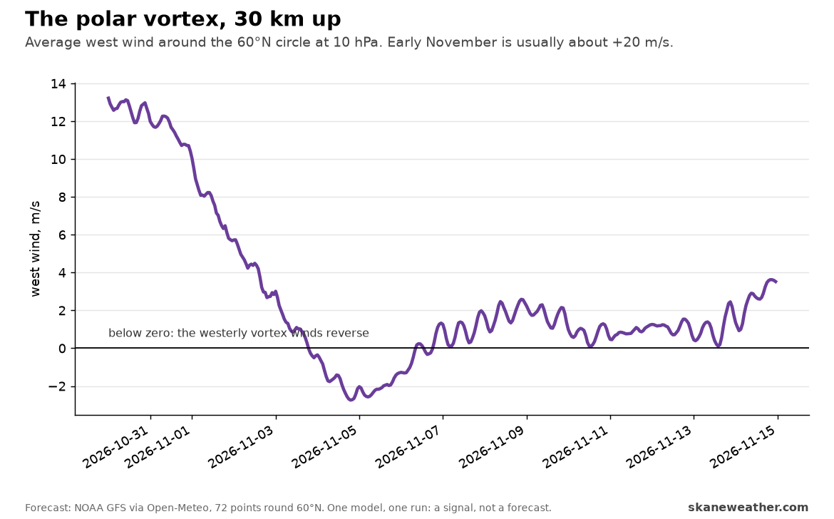
| A stratospheric warming late in November could split the polar vortex | NOAA's GFS goes further: the west wind round the vortex, 30 km up, reverses around 4 to 6 November, the textbook sign of a major warming. One model, one run, and ECMWF's open data does not reach that high | A real signal, and earlier than late November; not yet a forecast |
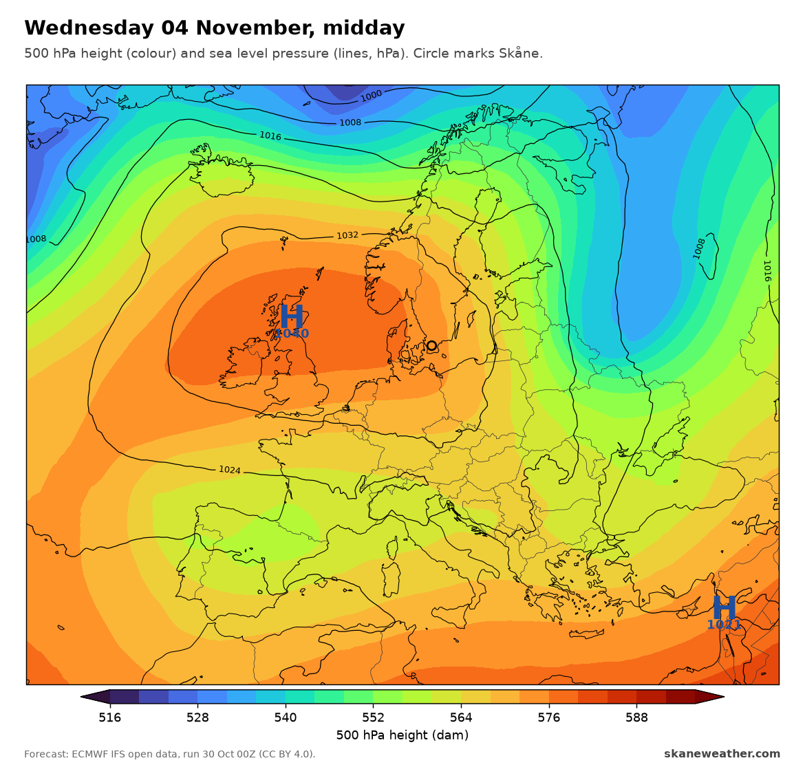
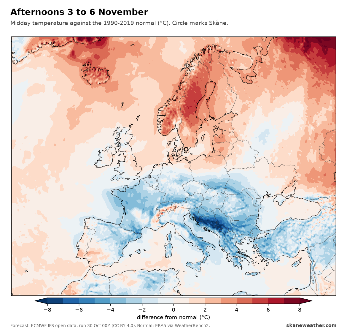
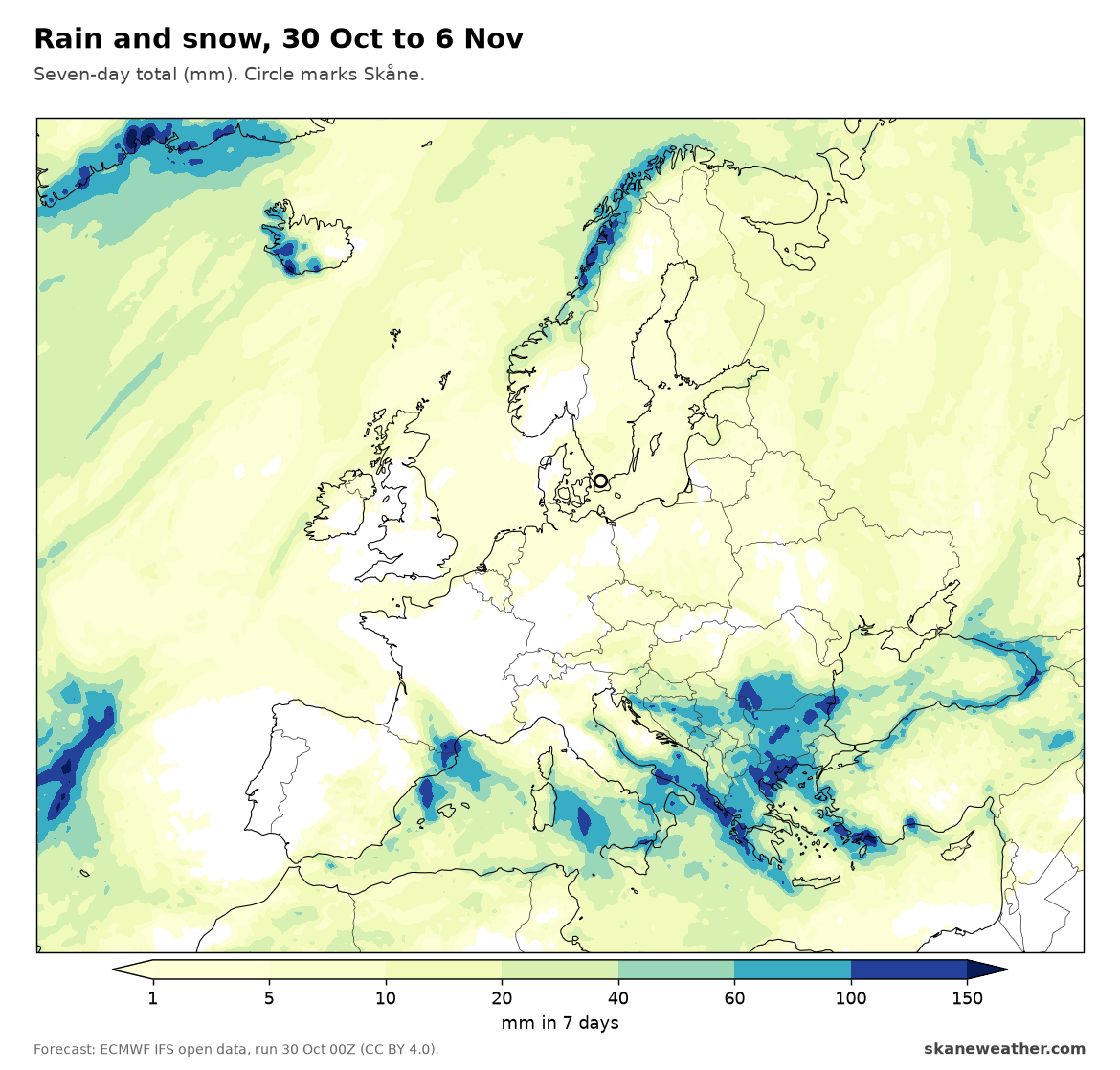
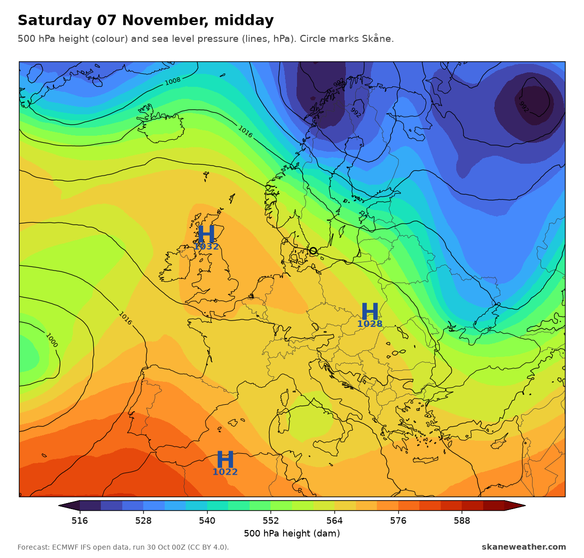
The block's end shows best in the ensemble. Every run agrees until Wednesday. From Thursday the lines fan out, and by Sunday 8 November most runs have Atlantic lows back over Britain.
The stratosphere is the wild card. A reversal this early in the season is unusual. If it happens, the effects at the ground usually come two to six weeks later, so "later in November" is about when it would matter, not when it would start. We will follow it.
Skåne, close up
Skåne is not under the cold. We sit on the eastern side of the high: 1032 hPa on Sunday, 1036 on Wednesday, with light winds. That keeps us mild and mostly dry. Malmö has days of 8 to 12°C and nights of 3 to 8°C through Saturday 7 Nov, about a degree above normal. The only rain is a weak front on Monday 2 Nov, about 6 mm.
Under a high in November, the forecast comes down to one question: grey or clear? This is where the 2.5 km models earn their keep, and this weekend they disagree.
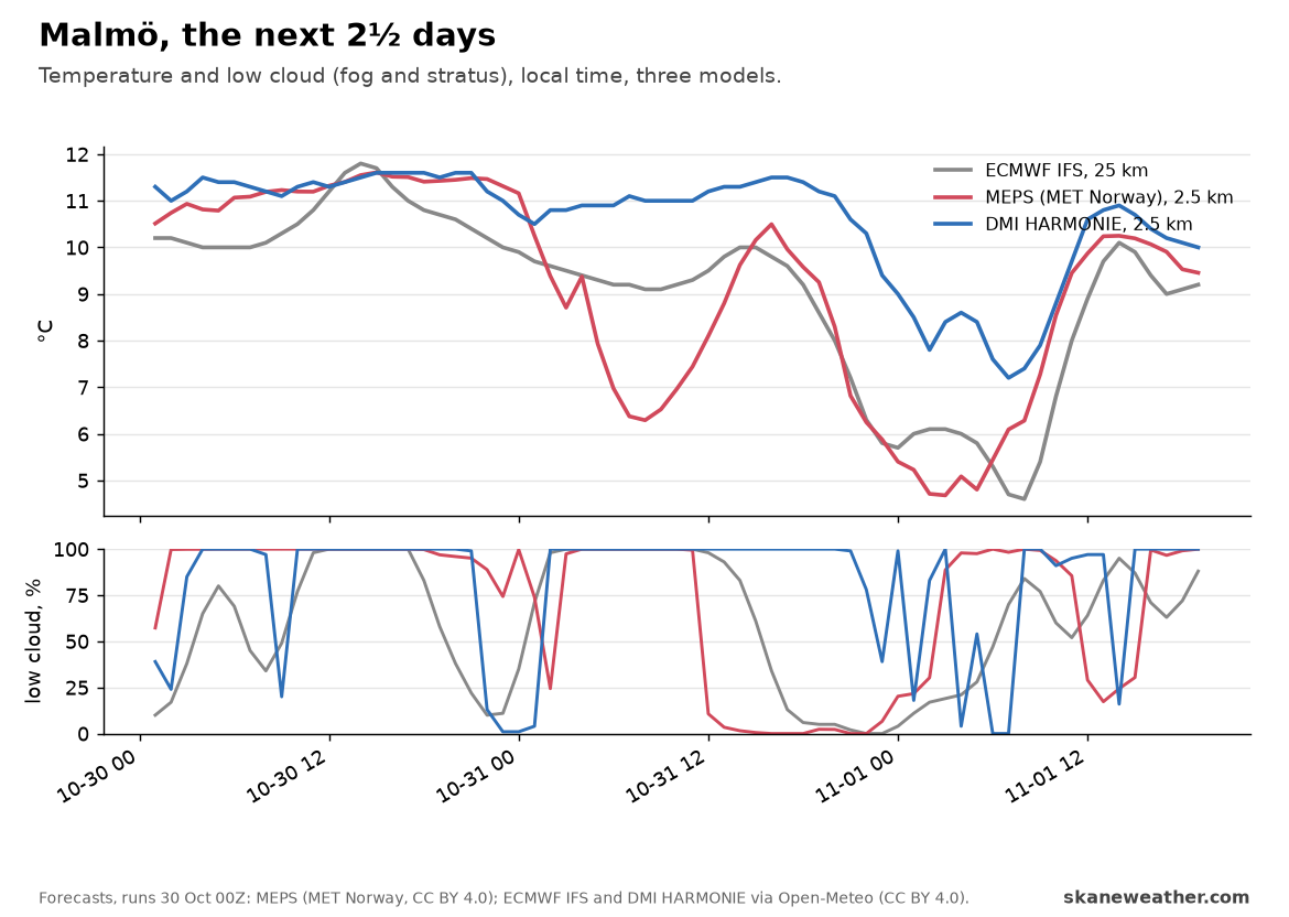
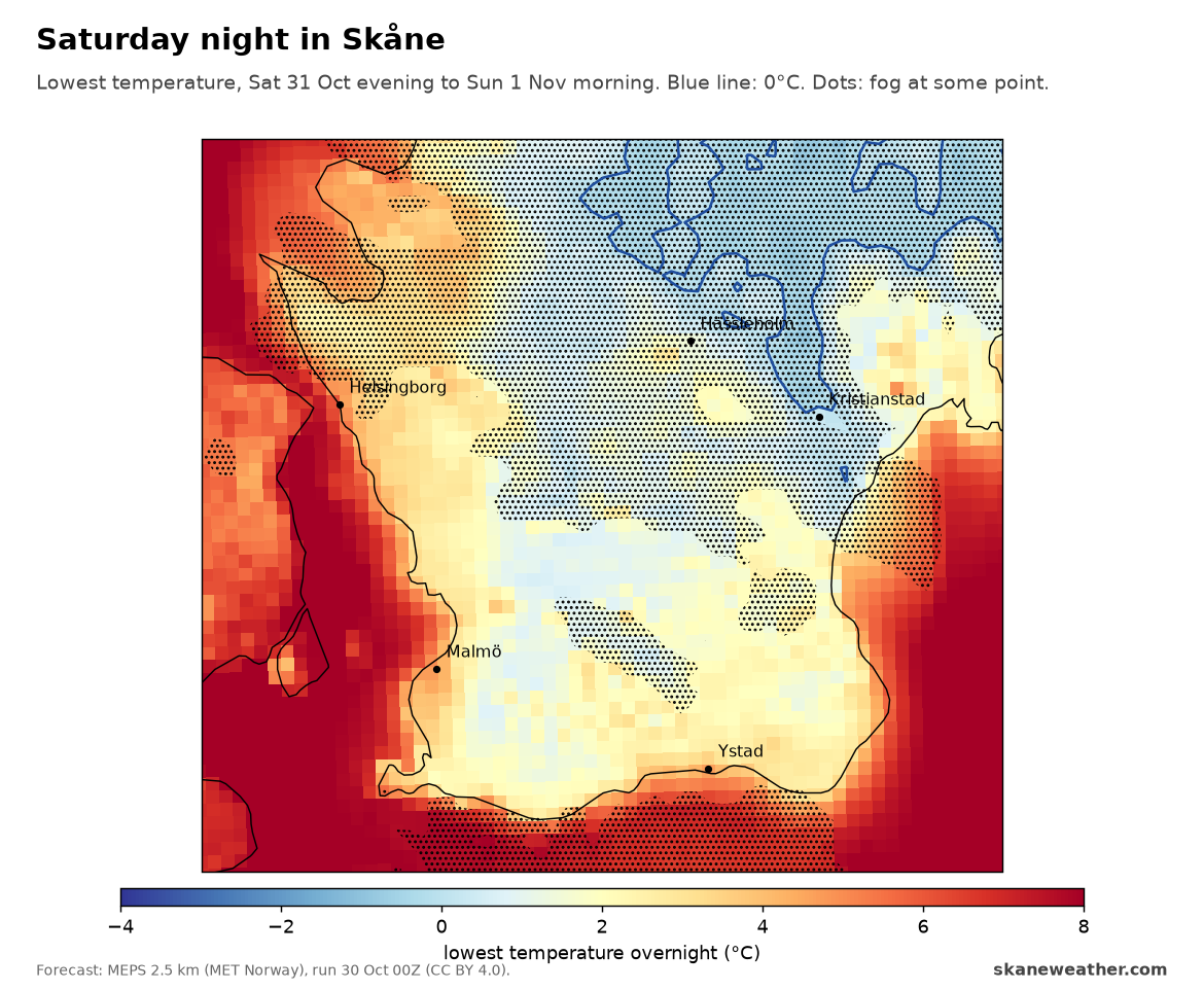
DMI's HARMONIE keeps a lid of low cloud over Malmö almost all weekend, and the night stays at 7 to 8°C. MEPS breaks it up on Saturday afternoon and evening, and Malmö drops to under 5°C. ECMWF sits close to MEPS.
If MEPS is right, Saturday night is the first frosty night of the season inland. In the northeast, around Hässleholm and Kristianstad, it reaches 0 to -1°C, with fog patches inland. The coasts stay at 4 to 8°C.
Bottom line: the big picture holds for the first week, but the block has a shelf life: in most runs it breaks down from about 7 to 8 November. For Skåne it means a calm, mild, often grey first week of November, with frost possible inland on clear nights.
Sources: forecasts from ECMWF IFS and IFS ENS open data, run 30 Oct 00Z (CC BY 4.0); MEPS 2.5 km, MET Norway (CC BY 4.0); DMI HARMONIE and NOAA GFS via Open-Meteo (CC BY 4.0). Normals: ERA5 1990-2019 via WeatherBench2.